University of British Columbia Okanagan geography student Jenna Taylor went home last month to spend time with her family in Flin Flon, Man.
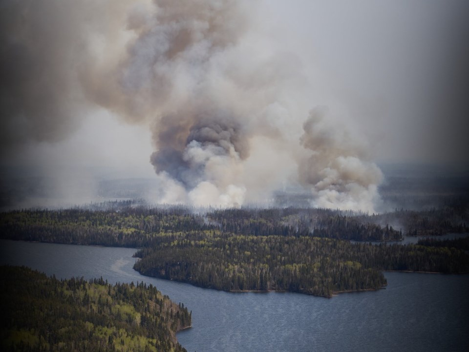
A relaxing break did not ensue. Taylor and her family would join thousands of evacuees on May 27, fleeing wildfires that prompted a provincewide state of emergency and spread to less than one kilometre from their home.
Instead of despairing, Taylor put her skills to use by building an interactive website to provide visualizations of the spread of the fires, their intensity and other information.
"I mean, it's so easy in a situation like this to just kind of constantly be doom-scrolling through social media," said Taylor, "and it's hard to be in the dark and not know what's going on."
By manually pulling data from Canadian government sites and NASA databases, Taylor was able to create a resource for others affected by the wildfires.
The site includes time-lapse visualizations of the fires, as well as wind and air-quality forecasts.
"In a way, it's hard because I wish I didn't have to make this project," Taylor said.
"The reality of it is that I'm in this situation, and I guess I did the best work I could for the position that we're all in."
To date, the Manitoba wildfires have displaced more than 17,000 people, including 5,000 residents of Flin Flon near the Saskatchewan boundary.
Among the hardest-hit locations was the village of Denare Beach, Sask., about 22 kilometres southwest of Flin Flon, where more than 200 primary residences burned down.
“It’s a place that we all hold really close to our hearts, and that’s really difficult,” said Taylor.
UBC Okanagan said the site was a "full emergency information hub."
It also lists ways for people to donate to evacuees and others suffering losses.
"I think that was my biggest thing was I wanted to spread awareness, not so much have this be simply like a fire update resource, because there's already lots of official government ones," said Taylor.
She credited a cartography and map-making course for the skills to build the site, which took her about two weeks.
"It was really nice to have that feeling and also know that I did something with my schooling that was more than just an assignment," said Taylor.
Jonathan Cinnamon, an associate professor with the university's Irving K. Barber Faculty of Arts and Social Sciences, said Taylor's website showed the real-world applications of such studies.
“A perfect example is Taylor’s invaluable website, which contains up-to-date wildfire and weather maps to support decision-making in affected communities,” said Cinnamon.
Residents of Flin Flon have been told they may be able to return by the middle of next week as officials prepare to lift the mandatory evacuation order.
"We're all ready to go home," said Taylor, "Hopefully, I can go back home to Flin Flon soon, and then in September, I'll be back in school, and I'm excited to be able to finish my degree soon."
She said her career goal was supporting people when devastating events occur.
"I think that'd be really cool one day."
This report by The Canadian Press was first published June. 18, 2025.
Nono Shen, The Canadian Press


