After more than 160 years of searching to understand the fate of English explorer Sir John Franklin’s fabled arctic voyage, the 2014 Victoria Strait Expedition team located one of Franklin’s historic ships and thus solving one of the world’s greatest archaeological mysteries.
The Victoria Strait Expedition, which was led by Parks Canada, brought together the Government of Canada and an unprecedented number of organizations from the public, private and non-profit sectors. The combination of state-of-the-art technology with 19th century Inuit oral testimony led to the discovery of HMS Erebus of the ill-fated 1845 Franklin Expedition.
The discovery of HMS Erebus, one of Sir John Franklin’s two lost ships, is a significant occasion for Fisheries and Oceans Canada as it showcases the important work of the Canadian Hydrographic Service (CHS) and the Canadian Coast Guard (CCG). Along with public and private partners, the Canadian Hydrographic Service and the Canadian Coast Guard joined the Victoria Strait Project with a number of common objectives such as mapping Canada’s Arctic seabed, conducting arctic research and searching for the lost ships of Sir John Franklin’s 1845 voyage to find the Northwest Passage.
This discovery provides an important opportunity to recognize the work of both the Canadian Hydrographic Service and the Canadian Coast Guard during the Victoria Strait Project and, more importantly, their work in improving navigation safety as well as contributing to scientific advancements.
During this year’s project, the Canadian Hydrographic Service conducted hydrographic surveys to collect high resolution bathymetric data using multibeam sonar equipment, a cutting-edge technology that transmits hundreds of beams of sound through the water to capture highly detailed images of the seabed.
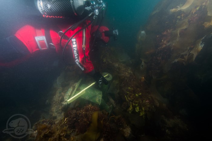
This technology allows the Canadian Hydrographic Service to see 100% of the seabed and to detect all hazards to navigation. The data collected from the Canadian Hydrographic Service multibeam sonars was used to produce three-dimensional images of HMS Erebus, which were used by marine archeologists to confirm the identification of the wreck. The multibeam data is being used by archeologists and researchers as they conduct further analyses of HMS Erebus.
The Franklin Expedition ships, Her Majesty’s Ship (HMS) Erebus and HMS Terror, are an important part of Canadian history, laying the foundations of Canada’s Arctic sovereignty nearly 200 years ago.


