WESTERN PRODUCER — Identifying and quickly addressing weed patches has never been more important as herbicide-resistant weeds increasingly menace farmers across the country.
Accurate maps of weed locations are a good first step to squash them before they can spread. There are both established and emerging technologies that can produce precise weed maps.
Some weed maps require innovative technology to produce, but there are also strategies to create useful weed maps that require relatively cheap and accessible equipment.
For instance, an applied research organization based in southern Alberta, Farming Smarter, is experimenting with patch management strategies for kochia.
An important part of the study is to map where the kochia patches are located by combining maps of crop yield, drone imagery, and soil conductivity.
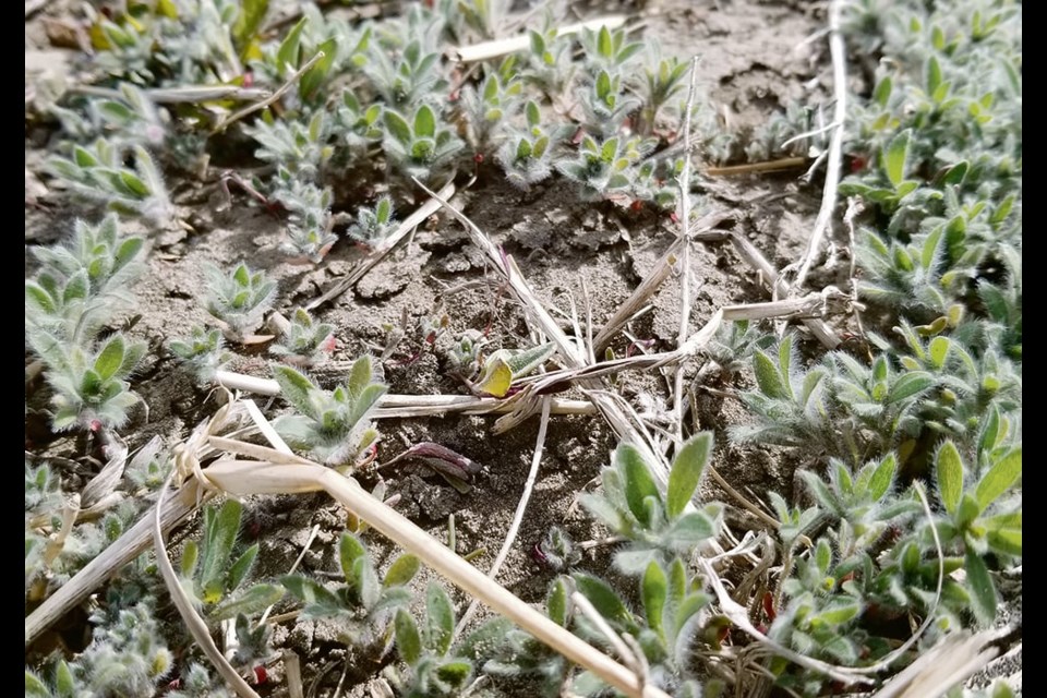
Lewis Baarda, a field test manager at Farming Smarter who ran the study, said kochia maps can be made cheaply and easily with the use of drone imagery and green-on-brown image analyses that identify green plant material in a brown or black background.
This can be done later in the season when a crop has ripened but the kochia is still green.
“It’s relatively easy to get up there with a drone or use satellite imagery and identify where the kochia is and where that weed bank is going to be that following year,” Baarda said.
“We mapped them and then we had our technicians get out there and to measure how many weeds were on the ground and see how accurate our maps were, which was I think 90 percent accurate. It did a pretty good job.”
He said if green-on-brown image analysis is used, it’s important to know the weed species on the field because this strategy will tell you where the weeds are, not what they are.
The study then used variable-rate herbicide to apply herbicides only where they were needed.
Baarda said precise weed maps can combat herbicide resistance.
“If you have 30 acres of high weed pressure, like kochia, you could add an extra mode of action just in that spot. So, as we kind of move to dual tank spraying technology or maybe drone spraying, this mapping approach kind of gives us a tool to do that,” Baarda said.
A weed map of kochia can be produced one year that can help inform farmers where they should apply residual herbicides the following year.
This can significantly reduce input bills compared to blanket applications.
Charles Geddes, an Agriculture Canada research scientist at the Lethbridge research centre, said many integrated weed management techniques require a good understanding of the location and types of weeds being dealt with.
Geddes said most farmers on the Prairies deal with herbicide-resistant wild oats, which generally start in patches before moving across fields.
He said increasing seeding rates is one of the most consistent integrated weed management methods that fights herbicide-resistant wild oats.
Increasing seeding rates works especially well in small grade cereal crops like wheat and barley, because it helps the crops compete with wild oats and reduces the amount of weed seeds going back into the seed bank.
Increasing seeding rates only where weed pressure is high can increase crop competition where it’s needed, without the cost associated with bumping up seeding rates across an entire field.
“So, if a farmer was able to map where those wild oat patches occurred in a field, they would actually be able to potentially develop a prescription or variable-rate seeding map,” Geddes said.
“It doesn’t necessarily have to be a prescription for where you buy herbicide or increase seeding rate. It could be any other in integrated weed management.”
For instance, he said growers can combine weed maps with yield maps to find areas in the field that are not making a profit, which could be seeded down to a perennial forage that can compete with the weeds.
“Fields are not uniform, so it doesn’t necessarily make sense to apply a single practice across the entire area of a field if it’s not uniform. I do think that there is potential using weed mapping and potentially even combining it with other types of mapping to determine which practices you should be implementing and where,” Geddes said.
He said crop advisers might want to offer weed mapping services, because plenty of producers are too busy to produce their own.
An Australia company called Single Ag offers a weed mapping service in that country with drones that can detect four-centimetre weeds at 200 hectares (494 acres) per hour, to facilitate variable-rate applications.
Single Ag provides weed maps to farmers, who use traditional sprayers to apply a flat rate of glyphosate,. Where larger weeds are detected, the rate of glyphosate is increased.
Spray expert Tom Wolf of www.sprayers101.com, said any sprayer with pulse width modulation (PWM) could do this, as long as the rate controller can receive and execute the weed maps.
“If you already have a PWM machine and you have the software that allows the single actuation depending on what the map says, then the drone option does give you a nice entry point to spot spraying without having to have a sensor,” Wolf said.
He said he also likes the practice of mapping weeds before treating them because it gives growers options.
“Having a map in advance of the spray operation, you can pencil out some costs and make some decisions and do some thresholding. If you don’t need to treat the whole field, you can target your route. You can specify the route that you’re spraying, just for the areas that are most serious and neglect the ones that are less serious,” Wolf said.
Spot spray systems that use boom-mounted cameras, including John Deere’s See and Spray, and Greeneye Technology, do not require weed maps prior to a spot-spray application.
These systems identify and treat weeds within crop canopies without working off a pre-existing weed map.
However, these systems are also capable of producing weed maps that can be useful to help growers gain a better understanding of what the weeds are doing.
“Right now, all of our pre-emergent work is broadcast for the whole field because we assume that weeds could be anywhere. But, if you have a number of layered maps from a drone, they could even be post-spot sprayed with a boom-mounted camera, if you can save those maps and most of them can,” Wolf said.
“You can then develop a map that’s layered over many times in the season or multiple seasons to get a very good idea of where your weeds are. Then maybe you could have a targeted pre-emergent map as well.”
For pre-emergent applications, Wolf said for cost effective mapping, the drones have to fly reasonably high to be productive, but this reduces the map’s resolution.
For instance, the Single Ag system detects weeds four cm in size, but that wouldn’t work for a selective pre-seed application in Canada.
“In Western Canada, where most of our non-selectively control is done pre-seed, those weeds (4 cm) are bigger than we would ever wait for. We spray weeds that are maybe a centimetre across and less,” Wolf said.
“If you want to have that kind of a weed map, you’d have to fly lower with a higher resolution image and it would take more time.”
A weed mapping service that is available this summer is offered by Croptimistic Technology with the company’s SWAT CAM.
The SWAT cam uses a camera mounted on each boom that captures images every 50 to 70 feet. The images are automatically uploaded to the company’s software that assesses the crop versus weed leaf area.
Users then receive an auto-generated crop and weed map summarizing the crop and weed data by zones.
This information can be used for variable-rate herbicide applications, establish long-term crop and weed-growth trends, and help with product performance enquiries and insurance claims.
Another weed-mapping product that will be available to Canadian farmers this summer is offered by Regina-based Precision AI.
Precision AI is selling a drone-based survey system based on the artificial intelligence and sensing system it developed for its spray drone, which is capable of green-on-green applications.
Daniel McCann, chief executive officer of Precision AI, said the company’s survey system could alert growers when herbicide-resistant weeds emerge.
He said users could fly the system around 10 days after the in-crop herbicide treatment to see if there are weed patches that survived the application.
These patches could then be investigated, as well as treated again with a targeted application using a different product.
The number of herbicide-resistant weeds and the cost of herbicides are both increasing, as is the skittishness of consumers when it comes to crop protection products, so there is pressure on farmers to become more precise with herbicides, and precise weed maps can help growers pinpoint their applications.