Blizzard advisory for several communities in southeast Saskatchewan, including Estevan, was cancelled at 6:25 p.m.
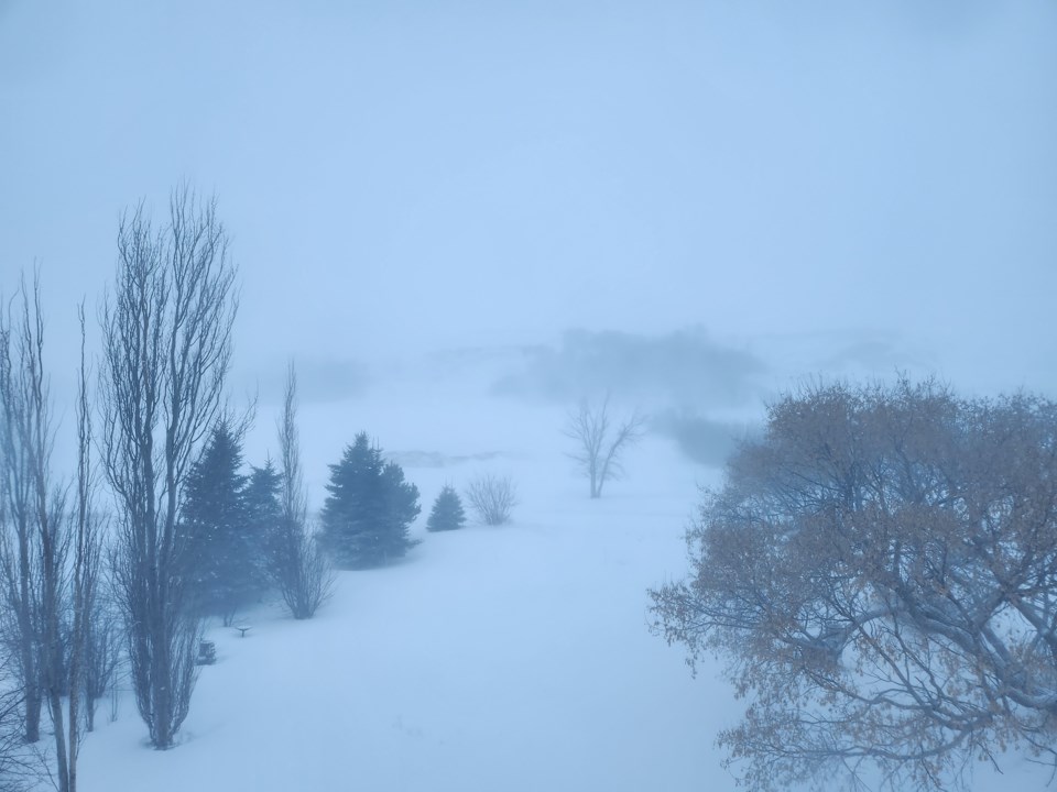
Blizzard conditions have eased in the southeast of the province, however northeast winds gusting up to 50 km/h will continue to give poor visibility in snow and blowing snow this evening. Condition should improve as winds diminish late this evening.
Travel is expected to be hazardous due to reduced visibility in some locations. Be prepared to adjust your driving with changing road conditions. Consider postponing non-essential travel until conditions improve.
***
Original report:
Environment Canada has updated and extended the blizzard advisory for the southeast at 4:50 p.m.
Conditions are slowly beginning to improve in southeast Saskatchewan as of late this afternoon, and will continue to improve this evening as the low pressure system which brought snow and blowing snow continues to move away.
The blizzard warning will likely be lifted early this evening.
As of 4:50 p.m., blizzard warning in effect for:
- R.M. of Benson including Benson
- R.M. of Brokenshell including Trossachs
- R.M. of Caledonia including Milestone and Parry
- R.M. of Cambria including Torquay and Outram
- R.M. of Cymri including Midale Macoun and Halbrite
- R.M. of Estevan including Estevan and Hitchcock
- R.M. of Fillmore including Fillmore Creelman and Osage
- R.M. of Griffin including Griffin and Froude
- R.M. of Lake Alma including Lake Alma and Beaubier
- R.M. of Laurier including Radville
- R.M. of Lomond including Colgate and Goodwater
- R.M. of Norton including Pangman and Khedive
- R.M. of Scott including Yellowgrass Lang and Lewvan
- R.M. of Souris Valley including Tribune and Oungre
- R.M. of Wellington including Cedoux Colfax and Tyvan
- R.M. of Weyburn including Weyburn and McTaggart
***
Environment Canada extended the blizzard advisory for southeast Saskatchewan.
As of 10:55 AM blizzard conditions continue to be reported, with Estevan reporting zero visibility in snow and blowing snow with easterly winds gusting as high as 80 km/h. Numerous road closures have been reported in the area. The blizzard will likely persist for most of the afternoon, with slight improvement expected later today as winds diminish somewhat, and more significant improvement this evening.
Travel is expected to be hazardous due to reduced visibility. Rapidly accumulating snow will make travel difficult. Visibility will be suddenly reduced to near zero at times in heavy snow and blowing snow. Prepare for quickly changing and deteriorating travel conditions.
If you do travel and become lost, remain where you are until the blizzard has passed. Protect yourself from wind, cold and disorientation by staying sheltered, indoors or with your vehicle. If you must travel, keep others informed of your schedule and destination and carry an emergency kit and mobile phone.
Limit outdoor activities. Ensure that shelter is provided for pets and outdoor animals. Public Safety Canada encourages everyone to make an emergency plan and get an emergency kit with drinking water, food, medicine, a first-aid kit and a flashlight. More information on emergency plans and kits can be found at getprepared.ca.
As of 11:03 a.m., blizzard warning was in effect for:
- R.M. of Benson including Benson
- R.M. of Brokenshell including Trossachs
- R.M. of Caledonia including Milestone and Parry
- R.M. of Cambria including Torquay and Outram
- R.M. of Cymri including Midale Macoun and Halbrite
- R.M. of Estevan including Estevan and Hitchcock
- R.M. of Fillmore including Fillmore Creelman and Osage
- R.M. of Griffin including Griffin and Froude
- R.M. of Lake Alma including Lake Alma and Beaubier
- R.M. of Laurier including Radville
- R.M. of Lomond including Colgate and Goodwater
- R.M. of Norton including Pangman and Khedive
- R.M. of Scott including Yellowgrass Lang and Lewvan
- R.M. of Souris Valley including Tribune and Oungre
- R.M. of Wellington including Cedoux Colfax and Tyvan
- R.M. of Weyburn including Weyburn and McTaggart
***
Blizzard conditions continue this morning, said Environment Canada in an update issued at 4:26 a.m. on Saturday.
A blizzard with strong winds and significant falling snow developed overnight. Widespread poor visibilities are expected to continue this morning and whiteout conditions will be possible at times. Total snowfall amounts of 15-25 centimetres is forecasted to fall by Saturday evening.
The blizzard is forecast to ease later this morning and through the early afternoon as winds diminish. Accumulating snow will taper off Saturday evening.
Please refer to local forecasts for more details on the expected conditions and timing of this system.
Travel is expected to be hazardous due to reduced visibility. Rapidly accumulating snow will make travel difficult. Visibility will be suddenly reduced to near zero at times in heavy snow and blowing snow.


