Perhaps we were due for a bit of a cold snap after a mild end to 2016, but locals still weren’t impressed with the biting temperatures that hit much of the province last week.
It was so bad that officials with Environment Canada issued warnings for “extreme cold” starting on Tuesday, January 10, starting with the Saskatoon area, but those soon became warnings for many parts of Saskatchewan.
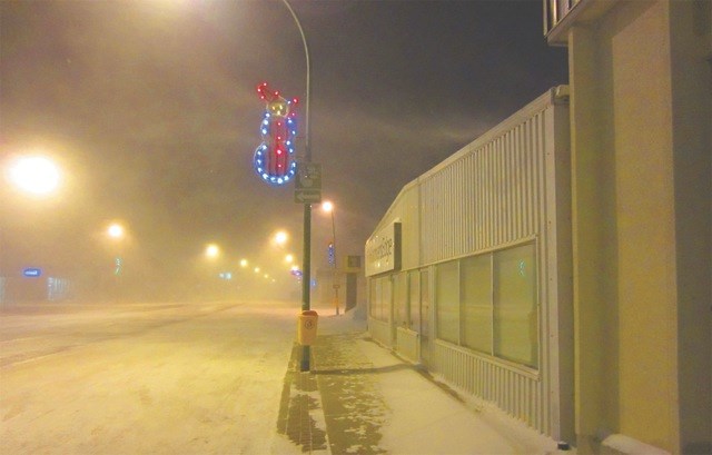
In the Outlook and surrounding area, temperatures dropped as low as -41 with the wind chill, and speaking of the wind, it certainly made its presence known on the night of Wednesday, January 11; whipping snow across streets and roads and making for some rocky driving conditions.
In some parts, the wind chill caused temperatures to drop as low as -45. With the high wind gusts accompanying these freezing conditions, Environment Canada meteorologist John Paul Cragg says it’s an “unusual” occurrence, as cold air typically involves an area of high pressure and wind doesn’t become a factor.
Cragg attributed it to what’s called a “Mackenzie low” sliding down from the Northwest Territories through the province and accompanying the frigid air.
Some peak wind speeds observed in the local area include Rosetown reporting 78 km/hr, and Elbow reporting freezing gusts of an incredible 81 km/hr.
As the extreme cold held a firm grip on communities across Saskatchewan, the province actually ended up breaking a record for power use, and matched another one-day record for natural gas use, which were both set last month.
According to SaskPower, at 5:51 pm on Thursday, Saskatchewan homes and businesses reached 3,747 megawatts of power, breaking the 3,726 MW record on Dec. 16, when the temperature dipped to -31 C. Prior to that, the highest peak was 3.710 MW four days earlier.
In a complete turnaround from the nasty temperatures, weather conditions at the beginning of this week in the Outlook area were more than tolerable, reaching as high as +2 on Monday. Further data called for even more plus temperatures heading into the end of the work week.


