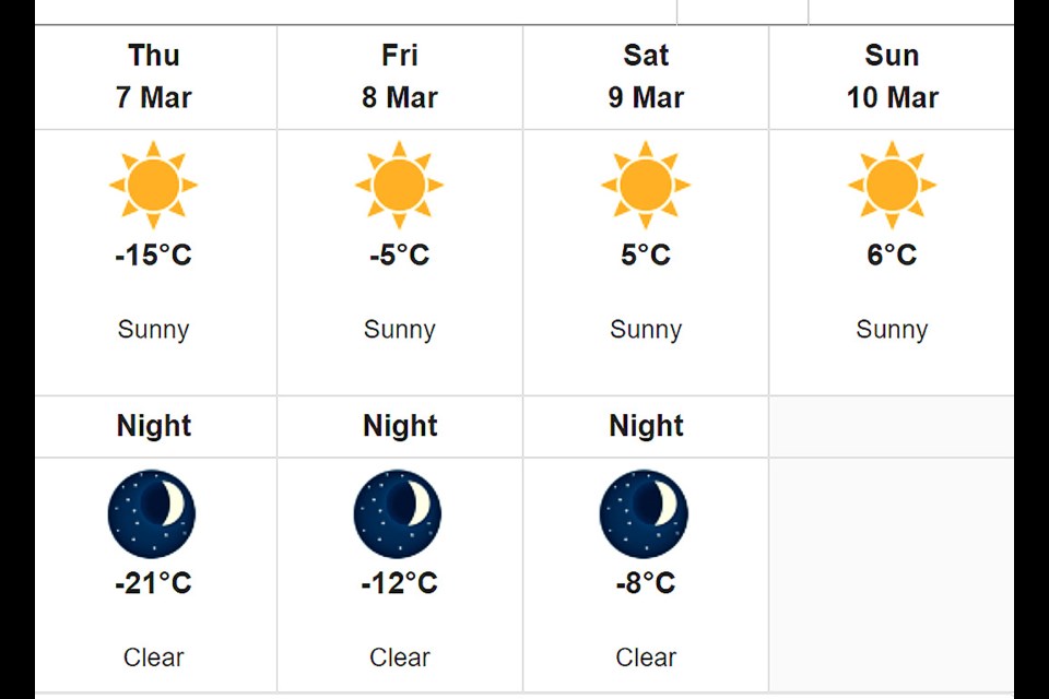
We're still digging out from the weekend storm, and news comes that we could see plus temperatures by the weekend, even though many of us are under an extreme cold warning. As we've said before, welcome to Saskatchewan.
A ridge of high pressure is settling in over southern Saskatchewan, giving way to clear skies and cold temperatures. The cold air mass and clear skies combined with freshly fallen snow will result in overnight lows in the minus 30-35 range. Winds are expected to be light overnight ranging from 10-15 km/h, however this will be enough to push windchill values towards the minus 40 mark overnight and into Tuesday morning. Temperatures are expected to moderate Tuesday morning.
The above forecast was presented for the Battlefords Monday morning by Environment Canada. Most communities are seeing similar forecasts, although the Battlefords is among the warmest. We'll have to see what transpires, as we are five days out.
Click through to the second photo to see who is under an extreme cold warning.


