Submitted
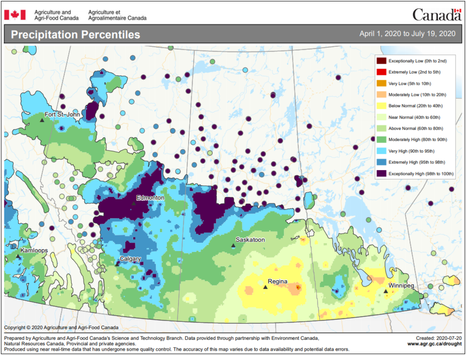
Northern Saskatchewan has received extremely high cumulative precipitation since April 1, resulting in very high flows and lake levels across the Churchill River Basin. In general, cumulative rainfall since April 1 is near record, according to the Water Seurity Agency.
High river and lake levels can be expected for the remainder of summer and in some cases into the fall and winter. In most areas flows and water levels are expected to peak, or have peaked, slightly lower than previous historical highs. However, flows and levels in the lower Churchill River, Reindeer River and Churchill River near Sandy Bay, are expected to exceed previous historical highs.
Below are specific conditions at various locations across the basin as well as project future peak levels:
Ile a la Crosse:
Present elevation: 421.97 m
Estimated peak: 421.1 m on or near July 25
Lac La Ronge:
La Ronge current elevation: 364.78 m
Projected peak: 364.83 m on or near Aug. 9
Sandy Bay
Present Elevation: 9.76 m (2190 m3/s)
Forecasted peak: 10.1 m (2400 m3/s) on or near Aug. 13
Cumberland House
Present elevation is 267.69 as of 9a.m. July 20
Forecast peak is 267.79 m on or near July 22
Future Rainfall
Central portions of the Churchill River Basin are expected to receive upwards of 10 mm of rainfall Monday. Additional rainfall is expected mid-week with potential accumulations of 20 mm possible.


