Redberry Lake Biosphere Reserve (RLBR) is one of three Saskatchewan Land Infrastructure Resiliency Assessment (LIRA) testing sites in the province through the project proponent of Saskatchewan Association of Watersheds (SAW). The Redberry Lake pilot site includes the rural municipalities and towns connected with the biosphere reserve including RM of Douglas, RM of Great Bend, RM of Meeting Lake, Town of Hafford and Village of Maymont. The other two testing sites in the province are Yorkton Creek and Lower Souris River.
The Redberry Lake BR was selected as host location for May 31 to showcase the tangible application of the tools and methodology of the LIRA project. The on-site tour demonstrated the impact of the multi-stakeholder partnerships necessary to successfully undertake such an initiative. LIRA complements both the regional planning within Redberry Lake and area as well as the mandate for the World Biosphere Reserve. LIRA involves preparing for climate extremes.
Communities benefit from participating in LIRA in a number of critical ways: by developing the knowledge and statistical data to assess regional flooding vulnerability and adaptation options, develop economic and science-based information for infrastructure investment, develop and incorporate a 25-year planning horizon for future growth, recognize risk management and mitigation, develop regional planning with multi-stakeholders, acquire economic and science-based information on ecological goods and services and be a mechanism to implement watershed based plans.
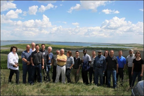
There were 20 individuals in attendance representing various organizations and government agencies. Representatives included Cameron Kayter, LIRA co-ordinator for pilot project AAFC/AESB; John Kindrachuk; Mary Ann Broda; Michael Newman, Canadian Forest Service part of Natural Resources Canada from Edmonton; Nick Partyka, Charles Linnell, Andrew Hawrysh, Walter Kyliuk, Elliott Hewitt, Rural and Cooperatives Secretariat AAFC; Erl Svendsen, Robert Armstrong, Harvey Hill, Christa Watson of Enterprise Saskatchewan NB; and Prairie Wild Consulting representatives Lenore Swystun, John Gyepi-Gabrah and Danny Roy.
RLBR has been working collaboratively with Prairie Wild Consulting to develop a long-term sustainable regional plan for the BR and area. The final outcome of the regional plan is to produce a future land use concept plan that will provide realistic information for rural and urban councils that can be used towards future planning.
"People recognize that everything on the landscape is connected but we do not always consider how what we do will affect our neighbours or other areas of the region," commented Cameron Kayter, LIRA co-ordinator. "By viewing the landscape as a region, we are able to reduce or eliminate personal and environmental conflicts and issues through careful collaborative planning using the templates, data and programs available."
John Kindrachuk, executive director for RLBR, opened the presentation by giving an overview of the RLBR and why LIRA complements the BR. Kindrachuk also discussed the developed partnerships consisting of federal and government agencies, non-governmental organizations, local watershed organizations, municipalities and being a project proponent of Saskatchewan Watershed Authority(SAW). The funding agent for LIRA is the Rural and Co-operatives Secretariat at Agriculture and Agri-Food Canada.
Cameron Kayter presented the LIRA project using national and regional context.
"Rural Canada is more reliant on transportation infrastructure which leads to increased susceptibility to extreme weather events," commented Kayter. For that reason he asked "What should be done to prepare for extreme rain events now and in the future?" He continued by explaining how the purchase of high resolution topographic data, Lidar, provided access to more advanced topography and geographic information. This results in a more detailed overview of some areas of concern especially within rural communities.
The goal of LIRA is to standardize a methodology to assist decision makers. It will assess the risk to infrastructure systems and the environment of extreme rainfall events and also develop and rank adaptation responses that decrease socioeconomic and environmental costs.
How does LIRA assess flood risk? There are five steps that were outlined by Kayter. The steps include: map landscape; extreme climate information; model and predict impacts; identify, develop and rank adaptation options; and reach an informed decision.
Kayter emphasized how using both the low quality elevation data (SRTM) and the high quality elevation data (Lidar) can be useful when combined with local knowledge and professional expertise to prepare for future land use. He presented a PowerPoint presentation that provided a visual example of how water can build up affecting land use and, with increased water accumulation either from rainfall or run-off, can cause water bodies to merge resulting in either water flow patterns or increased land coverage.
The next presenters were John Gyepi-Gabrah and Danny Roy of Prairie Wild Consulting who explained how local data was collected. There were 5,339 parcels of land surveyed within the RLBR with the assistance of summer staff.
The presenters explained what agricultural capture was. It is a GIS based data collection tool which allows detailed parcel by parcel capturing of both agricultural and non-agricultural land use activities. They also surveyed and assessed the infrastructure within the area paying particular attention to the age and condition of each system as well as the reason for it being installed.
"People must realize that zoning of land cannot be changed without an OCP. Saskatchewan is currently the only province that has not mandated a regional plan and only 30 percent have completed OCP," commented Lenore Swystun, project consultant for Prairie Wild Consulting.
Swystun continued by sharing the planning process, the regional planning initiative and the work completed to date.
"The Hafford Sustainability Community Plan and Zoning Bylaw has been adopted and provides the foundation for the RLBR District Official Community Plan (DOCP), and the participatory planning process has been ongoing since 2009 with public meetings, open houses, school engagement, surveys, etc."
A DOCP must contain statements of policy with respect to: sustainable current and future land use and development, current and future economic development, general provision of public works, management of lands subject to natural hazards such as flooding, management of environmentally sensitive lands, source water protection, means of implementing OCP, include future land use concept plans and zoning bylaws for each of the participating municipalities.
The next step in the overall LIRA project is to maintain local participation. It is key to utilizing existing partnerships with stakeholders such as watershed groups and municipalities and to building on the work that has already been done.
Round table discussion provided an opportunity for local stakeholders to share their thoughts and ideas. Nick Partyka, reeve of RM of Douglas, commented that by having access to topographical and geographical information, council can identify where land use can be utilized to its potential or where a proposed project may have environmental difficulties.
It is not about dictating where people place their buildings or farms but rather is about providing statistical information about what could be potential challenges in the future based on the climate and overall landscape.
"It is amazing what the pioneers established and passed onto the next generation," commented Andrew Hawrysh. "The plan is about developing sustainable agriculture and businesses."
Swystun addressed a question from the floor regarding how communities can keep leadership motivated within the community.
"Education and communication," answered Swystun, "base-line information is crucial for them to implement best informed decisions."
The overall message presented throughout the day included the importance of the LIRA project and how the advantages of regional planning can be utilized. According to the Rural Secretariat June 2009 statement "this program assists rural and northern regions to obtain information and develop tools, processes and the expertise to respond to rural and northern challenges and opportunities and to become more competitive by collaborating regionally, building on local assets and developing unused potential."
Redberry Lake Biosphere Reserve and its representing areas are well on their way to developing a District Official Community Plan that will benefit the region for future years.


